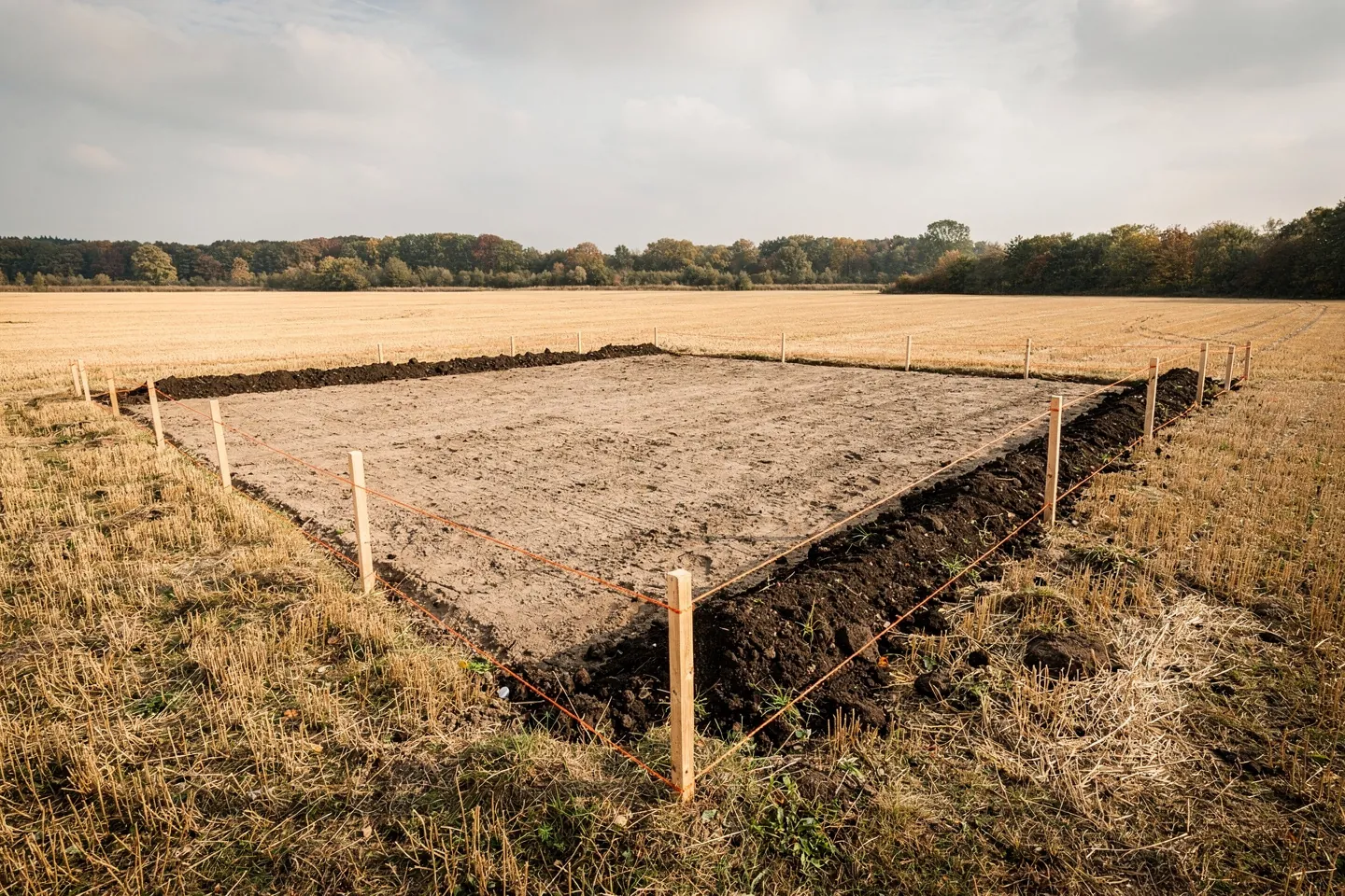
Why is a "building plot" often still a field?
The listing says "building plot", the price matches, and the municipality confirms that the land-use plan allows a family house on the parcel. Yet part A of the land registry extract lists the type of land as arable land or garden. Both statements can be true at once. The land-use plan sets the land-use category of the area, meaning what it may be used for in the future. The cadastre records what the plot is today. Until the two are brought into line, no house can legally go up on the parcel.
In everyday Slovak people speak of "vyňatie", taking land out of the agricultural land fund. Act No. 220/2004 Coll. on the protection and use of agricultural land uses the term withdrawal of agricultural land (odňatie), and treats as agricultural land every plot registered in the cadastre as arable land, hop garden, vineyard, orchard, garden or permanent grassland. The pillar article How to Choose a Building Plot gives this one paragraph. Here I walk through the whole procedure: who decides, when, what you pay for, and what to secure before you sign.
What does the type of land in the cadastre tell you?
The type of land is the first thing I read for any parcel, before the price. It tells you whether a separate procedure at the district office lies ahead, or whether the land has already been released for building.
| Type of land | Agricultural land? | What it means for building |
|---|---|---|
| Arable land | Yes | Withdrawal is needed before building; on high-quality soils this is the most strictly assessed case |
| Garden | Yes | Even a garden next to a house in the village is agricultural land; the procedure depends on area and position relative to the built-up area |
| Permanent grassland | Yes | Same regime as arable land, even if the meadow was never ploughed |
| Vineyard, orchard, hop garden | Yes | Vineyards are specially protected by the act; their withdrawal is exceptional and carries its own levy |
| Other area (ostatná plocha) | No | No withdrawal to deal with; often a plot from which the land has already been withdrawn |
| Built-up area and courtyard | No | Land under buildings and yards, outside the soil protection regime |
Watch out for subdivisions. Splitting a field into smaller parcels with a survey plan does not by itself change the type of land. The new parcels can be registered and sold as building plots while remaining arable land.
Land-use plan and soil protection: two consents, not one
The most common mistake goes like this: the municipality changed its land-use plan, so the plot is buildable. A change to the municipal land-use plan is only the first step. When preparing it, the municipality submits the areas it wants to develop to the agricultural land protection authority, which at this stage is the district office at the seat of the region. That office grants consent to the possible future use of the land for building and may attach conditions. The consent does not withdraw the land, though. It is a basis for a later withdrawal decision, issued for a specific project on a specific parcel.
If the municipality has no land-use plan, the regional district office may grant consent to an individual proposal. Under the act it is valid for three years unless the office sets a longer period; the limit does not run out if a withdrawal application is filed within it. How to read the plan itself is covered in How to Read a Municipal Land-Use Plan. For this topic one question matters, and you should ask it directly: was the area containing the parcel approved from the soil protection point of view, and on what conditions? The answer belongs in the written zoning information.
The boundary of the municipality's built-up area also matters. The act does not require a withdrawal decision when the agricultural type of land changes on an area of up to 1,000 m² inside the built-up area boundary. Even then it is no free pass: the district office issues an opinion on the project, and that opinion is the basis for the change in the cadastre. A plot just outside the built-up area goes through the full procedure, and the applicant must justify the location of the building with regard to protecting the best soils.
Who decides on withdrawal, and when?
Withdrawal is decided by the district office in whose district the plot lies; the agenda is handled by its land and forestry department. It is a separate procedure, not part of the building procedure, but the building procedure builds on it. The soil protection act states explicitly that a final decision on permanent withdrawal is a basis for issuing the building intent decision under Building Act No. 25/2025 Coll. In practice that means dealing with withdrawal in parallel with the permit design, not after it.
Among other things, the act requires the application to include:
- the project documentation,
- the consent from the land-use plan level, where required,
- a survey plan of the withdrawn area and a copy of the cadastral map,
- a certificate of the soil-ecological unit (BPEJ),
- a topsoil stripping balance prepared by a qualified person,
- the binding opinion of the spatial planning authority and statements from the parties and the authorities concerned.
The decision applies only to the approved project. If the land is not used for that project within three years of the decision becoming final, it lapses and the levy paid is not refunded. The office sends the final decision to the cadastre, which changes the type of land to "other area". The whole plot does not have to be withdrawn: the withdrawn area can be part of it, for example the footprint of the house, the driveway and paved areas. The design proposes the extent and the office approves it.
The levy: what does it depend on, and when is it not paid?
Whoever withdraws the land pays a levy. It goes to the state budget, not to the municipality, and its logic is simple: the better the soil and the larger the area, the higher the levy. Quality is expressed by the BPEJ code, a seven-digit figure that carries the climatic region, soil type, slope and other site properties. On that basis soils fall into nine quality groups. The protection authority is required to protect soils in groups one to four, so with them the issue is not just a higher levy but a real risk that withdrawal will not be granted. The BPEJ map is maintained by the soil service, the Soil Science and Conservation Research Institute.
The act itself does not set the base rates by quality group, the payment method, the due date or the exemptions. It delegates them to a government regulation, currently Government Regulation No. 58/2013 Coll. on levies for the withdrawal and unauthorised use of agricultural land. The regulation also adjusts the base rate: upward for land with a working irrigation system, downward for land that directly adjoins the built-up area of the municipality. The levy for permanent withdrawal is paid once, after the decision becomes final.
Exemptions exist, but they are narrow. They mainly cover public infrastructure such as roads, water sources and wastewater treatment plants, and they include land under a residential building up to a limited area. Whether an exemption applies to your house, how much of the area it covers and what levy you pay on the rest: have the district office calculate it before you buy. I deliberately give no amounts here: the only reliable calculation is the one the office makes from the BPEJ code of each part of the parcel.
Topsoil stripping: where does the top layer go?
Topsoil is not excavation spoil. The act requires whoever withdraws land permanently to strip the humus horizon and ensure it is used economically and purposefully. How is set by the topsoil stripping balance, a document prepared by a person with a master's-level degree in agriculture or natural sciences specialising in soil science. The balance determines how much topsoil must be removed and where it goes, and the district office approves it directly in the withdrawal decision.
For a family house it is natural to return part of the topsoil to the same plot, into the future garden and landscaping, if the balance allows it. In practice that means setting aside a stockpile location when planning the site, where machinery will not drive over it, and not mixing it with subsoil from the foundation excavation. Compacted, mixed topsoil shows in the garden for years. And until construction starts, the owner must look after the withdrawn plot, above all so that it does not fill with weeds and self-seeded trees.
What should you check before signing the contract?
Withdrawal rarely blocks a plot entirely, but it often changes the price, the schedule and who pays for what. These are the questions I ask before signing, and the people who can answer them.
| Whom to ask | What to ask | When |
|---|---|---|
| Cadastre (extract, map) | Type of land, register C or E, any pending-change flag | Before reservation |
| Municipality and building office | Land-use category, built-up area boundary, conditions of the soil protection consent | Before reservation |
| District office, land and forestry department | Whether a withdrawal decision has been issued, for what project and whether it is valid; BPEJ code and quality group | Before signing the purchase contract |
| Seller | Who files the application and who pays the levy; whether anyone has used the land without a decision | When negotiating the contract |
| Surveyor | Survey plan of the withdrawn area, boundaries matching the terrain | After purchase, before the application |
| Architect | Extent of the withdrawn area according to the design, documentation for the application | Before filing the application |
If the seller claims that "the withdrawal is sorted", ask to see the final decision and check which project it was issued for: a decision for a developer scheme with houses placed differently may not cover your house. And if withdrawal has not been dealt with, agree in the contract who will obtain it, who bears the levy and what happens if the office refuses it. The price of a plot that is arable land in the cadastre should reflect that cost and that risk.
The bigger picture: cities grow on the best soil
The levy is not an extra bureaucratic fee. It is the state's price signal that soil is a finite resource. The surroundings of Bratislava, Trnava and Nitra lie on lowlands and hill lands with some of the best soils in the country, and that is exactly where suburbanisation moves fastest. New streets of family houses on former fields create satellite settlements without schools, shops or public space, where every trip means a car.
The municipality pays for urban sprawl too: it has to extend technical infrastructure, roads and school capacity to an area that grew out of subdividing a field rather than out of a plan. A plot inside the built-up area, a gap site or a plot with an old house tends to cost more per square metre, but it saves the withdrawal, often the utility costs as well (see A Plot With No Utility Connections), and puts your home closer to services. When designing on a field, a compact footprint and modest paved areas help: less withdrawn land means a lower levy and more garden.
Summary
"Building" in a listing describes what is allowed on the plot, not what the plot legally is. The type of land on the registry extract tells you whether a withdrawal procedure lies ahead. The land-use plan and the soil protection consent tell you whether the project stands a chance. The district office tells you when, for how much and on what conditions. And have everything to do with amounts and exemptions confirmed at the district office before you sign.