Why does an old house almost never match its drawings?
Owners of old houses often keep yellowed drawings from the original building permit in a drawer and see a survey as an unnecessary expense. If the drawings exist at all, they describe the house that was meant to be built. Decades ago, builders worked with whatever material they could get, shifted partitions by eye and set windows into the openings that happened to come out. Then later owners arrived: a bathroom extension, a bricked-up door, a new chimney, an attic converted as a DIY project. None of it made it into the drawings, and for many houses the building authority archive holds nothing at all.
The result is a house whose walls are not square to each other, whose floors are not on one level and where the thickness of the same wall changes from corner to corner. You cannot see it by eye. In the design, though, it means the staircase does not fit the storey height, the kitchen units do not fit between the walls, a new lintel does not bear where the structural engineer assumed it would, and the bill of quantities counts areas that do not exist. A wrong survey does not show up while drawing. It shows up on site, when the material is ordered and the trades are waiting, which is the most expensive moment of the whole renovation.
I explained why the survey belongs at the very start in the article on the order of steps in a house renovation. This one is about how a survey is done and what you get from it.
Which methods are used to survey a house?
The methods differ in more than technology. Above all, they differ in when the decision is made about what gets measured. With manual measuring, a person decides on site, and whatever they did not measure, you do not have. With the methods grouped under the name reality capture, everything visible is recorded and the decisions are made during processing.
Tape and laser distance meter
The classic approach still works for a small, simple house. Room lengths, diagonals, clear heights, sills and openings are measured and written into a sketch. The weak points are exactly the diagonals and the height relationships between storeys: if they are not measured, the plan looks orthogonal even when the house is not. The result is exactly as good as the person holding the tape is thorough, and a missing dimension cannot be recovered without another visit.
Terrestrial laser scanning
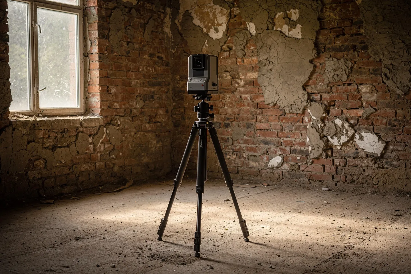
In laser scanning, the scanner stands on a tripod and from each setup records its surroundings as an enormous number of points with spatial coordinates, often with colour as well. The result is a point cloud. The scanner moves from room to room and the individual scans are then assembled into one whole. With a good instrument and careful processing the accuracy is high and, above all, uniform across the whole house, which manual measuring cannot take for granted. Technical literature on building documentation consistently reports that data capture is much faster than selective measuring with a tape or distance meter. Handheld mobile scanners collect data while walking; they are faster still, but their accuracy depends on the trajectory, the control points and the processing.
Photogrammetry
Photogrammetry builds a three-dimensional shape from many overlapping photographs. It suits facades, stone masonry, stucco details and anything where surface texture matters. It struggles with smooth white walls, glass and dark spaces where the software has nothing to hold on to. Its scale and reliable accuracy come from control points measured with another instrument.
Drones and phone lidar
Drone 3D reconstruction covers what you cannot see from the ground: the roof, chimneys, gutters, upper parts of the facades and the relationship of the house to the plot. Flying is governed by the European drone rules, the operator must be registered, and in Slovakia the Transport Authority (Dopravný úrad) oversees it, so this belongs to someone who does it routinely. Lidar in newer phones and tablets is useful for a quick sketch of a space during a site visit. I do not accept it as the basis for a design, though.
| Method | Good for | Weak point | When I choose it |
|---|---|---|---|
| Tape and laser distance meter | A small house with a simple layout, supplementary dimensions | Diagonals, heights and unevenness; only what the person thinks of gets measured | Layout study, minor changes with no structural work |
| Terrestrial laser scanner | The whole interior and exterior, roof structures, vaults, floor flatness | Blind spots behind furniture, large data volume, demanding processing | Renovation with a new design, interventions in load-bearing structures |
| Handheld mobile scanner | Fast capture in a larger or complex house | Accuracy depends on the trajectory and control points | Overview of condition, large buildings, filling gaps in scans |
| Photogrammetry | Facades, stone masonry, ornamental details, textures | Smooth and glossy surfaces, darkness, need for control points | Facade restoration, heritage-value details |
| Drone | Roof, chimneys, upper facades, surroundings of the house | Cannot capture the interior, flying is regulated | Roof replacement, an added storey, the site plan |
| Phone lidar | A sketch of the space during a site visit | Accuracy and completeness are not enough for a design | First orientation before a decision |
How do separate measurements become one house?
The least visible and at the same time the most important part of the work is joining. Scans from individual rooms must be tied to each other through doorways, along the staircase and between storeys. This step is called point cloud registration. If it is done carelessly, errors accumulate and the attic shifts relative to the ground floor in the cloud. That is why it pays to ask the provider how they check the registration and whether they verify the result with independent measurements.
When an extension, an added storey or regrading of the terrain is planned, the house survey is tied into the coordinate system the land surveyor works in, so that the design also fits the plot boundaries and the surrounding levels.
What do you receive, and what does the architect actually need?
Clients often imagine they will receive a model they can rotate on screen. They can get one; the question is whether they need it. The deliverables serve different purposes and take different amounts of processing, so they are agreed before the survey, not after it.
| Deliverable | What it is | What it is used for | Who works with it |
|---|---|---|---|
| Point cloud | Raw spatial data from the scanner or photogrammetry | Archive of the condition, checking any dimension, sections cut afterwards | Architect, structural engineer, land surveyor |
| 2D drawings of the existing condition | Plans, sections and elevations at an agreed level of detail | Basis for the design, the permit and the bill of quantities | Architect, cost estimator, building authority |
| As-built model | A 3D model with walls, floors, openings and roof | Design in BIM, clash checking, visualisations | Architect, building services engineers |
| Facade orthophotos | Scaled, rectified images of the facades without distortion | Facade restoration, window replacement, colour scheme | Architect, conservator |
| Panoramas from scan setups | Spherical photographs linked to the point cloud | Checking details without a trip to site | Everyone on the project |
| Accuracy report | A report on the registration and the check measurements | Evidence that the data can be relied on | Architect, structural engineer |
For a family house design I need reliable 2D drawings first of all: plans of every storey including the cellar and the roof space, at least two sections, elevations and level marks for floors, ceilings and sills. Alongside that, the point cloud, because during design there is always a question nobody anticipated during the survey, for example exactly where a rafter runs above a new roof window. With the cloud I answer it at my desk without another trip to the house.
An as-built model makes sense when the design is drawn in BIM and when several disciplines meet on it. The scan-to-BIM process, converting the cloud into a model, is a separate piece of work with its own scope. For a small house with a simple roof I do not require it automatically; for a complex roof structure, vaults or leaning walls I do. Agree the formats too: the point cloud in an open format such as E57 and the model in IFC, so you are not tied to one piece of software. The client paid for the data and it should stay theirs.
What can a survey not see?
A scanner and a camera both record the surface. They cannot tell what the masonry is made of, where the services run, whether a floor is timber-joisted or built from ceramic infill blocks, or whether a wall is wet. A survey therefore never replaces the investigations that look inside the structure:
- Probes into plaster, floors and ceilings reveal the build-up, the material and how the beams bear. For interventions in load-bearing structures the structural engineer makes them, as I describe in the article on removing a load-bearing wall.
- Moisture measurement and sampling distinguish rising damp from leaks or condensation and determine the salt content of the masonry.
- Thermal imaging in the cold season reveals thermal bridges, air leaks and suspicious spots that need to be checked with a probe.
- A camera inspection of the drains and a cable and pipe detector show routes that are invisible under plaster or under the floor.
- A close inspection of the roof timbers finds rot and wood-boring insects in places the scanner records only as shape.
Survey and probes complement each other. A probe tells you what is in the wall; the survey tells you exactly where that wall is and how thick it is. Findings from the probes should be written into the existing-condition drawings, otherwise they are forgotten during design. If you are still buying the house, most of these investigations are destructive and belong after signing, as I write in the article on buying an old house.
A digital twin of a family house: an honest maybe
A digital twin is a model of a building linked to data about how it operates. For hospitals, office buildings or factories it makes sense, because the facility manager runs a great deal of technology and every improvement multiplies. For a family house the honest answer is maybe, and probably not in its full form. Few people will keep an up-to-date model with sensors running for years.
Its modest version does have value, though. Before plastering and covering the floors, have the open walls scanned or at least systematically photographed. A point cloud with the real routes of the services is a document that saves a lot of guessing when drilling for a shelf, during the next alteration and when selling the house. For a family house that is more than enough.
How do you commission a survey that can actually be used?
- Be clear about the intent. The scope of the survey depends on what will be done. If you are still deciding whether to renovate the house or demolish it, read about choosing between renovation and a new build; the survey is an input to that decision too.
- Empty what you can. Furniture against the walls creates blind spots, and wardrobes hide exactly the corners where damp and cracks tend to be.
- Agree the deliverables in writing. Which drawings, at what level of detail, whether the roof space, the cellar and the surroundings are surveyed, and in which formats you receive the data.
- Ask how accuracy is verified. A serious provider can tell you how they check the registration and how they document the result.
- Combine the survey with the probes. Ideally schedule them so that findings from the probes go straight into the drawings.
- Have the raw data handed over. The point cloud will serve you long after the design is finished.
The survey is a small line in a renovation budget, but it decides whether the large ones will fit. A house measured by guesswork gets designed a second time, on site and at full price.