Three plots and one decision
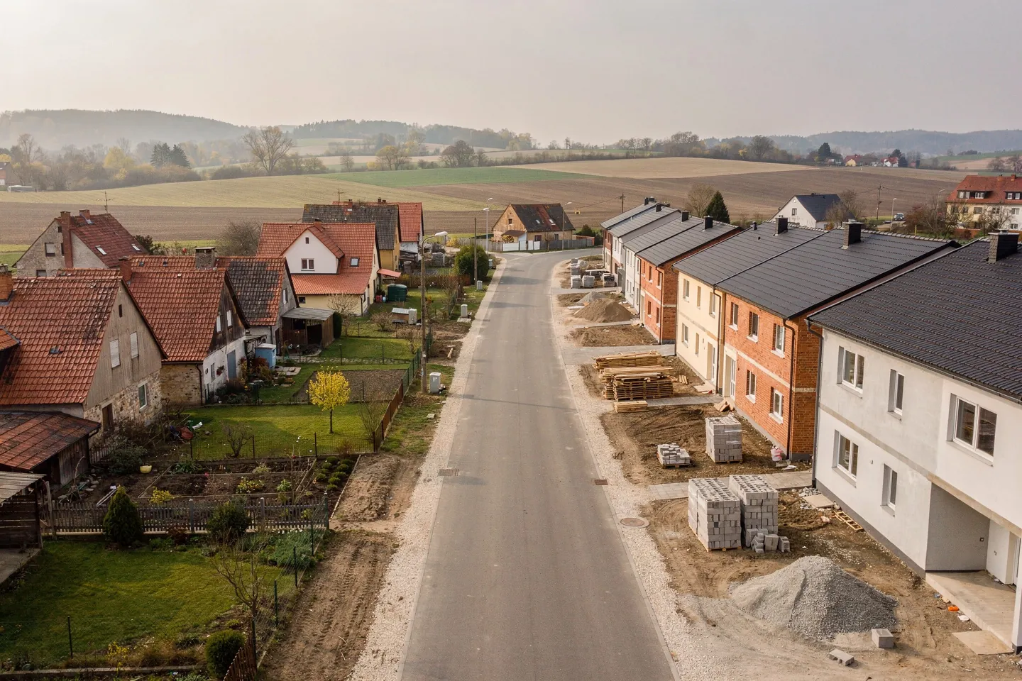
Anyone looking for a plot around Bratislava, Košice or a regional capital ends up, sooner or later, facing the same decision. On the table lies a smaller and more expensive plot inside the town, a larger and cheaper plot in a new development beyond its edge, which Slovaks call a satellite, and an older house with a garden in a village a little further out. Listings compare plot size and price per square metre. I compare something else: what kind of daily life that plot will prescribe for you over the coming decades.
I describe how to vet a specific parcel in the guide How to choose a building plot. This text sits one level higher, at the scale of the location. Urban infill in town, a new street in a satellite and a village with its own history are three different ways of living, not three price brackets of the same product. The difference between them does not show when you sign the contract, but every morning, when the children need to get to school and you need to get to work.
What the territorial plan says about where a town may grow
The fact that entire new neighbourhoods have grown on fields around Bratislava over recent decades is neither an accident nor a force of nature. It is suburbanization, the shift of housing from the city into its hinterland, and its concrete shape was set by the territorial plans of individual municipalities. Research by the Institute of Geography of the Slovak Academy of Sciences and studies of municipalities such as Chorvátsky Grob describe a similar picture: residential construction outran roads, utilities and schools, and the new areas are poorly connected to the city. Villages around Košice and the larger regional towns know similar stories, only at a smaller scale.
Act No. 200/2022 Coll. on spatial planning responds with principles worth reading. Under § 4, the planning authority is to set conditions for an efficient and sustainable settlement structure with regard to the availability of public transport and technical infrastructure, and to protect agricultural land from other uses. Under § 22(3), the municipal territorial plan determines, among other things, the boundary of the built-up area of the municipality and its main development areas. That boundary is the Slovak counterpart of what planners call an urban growth boundary: a line beyond which housing should not spill into the landscape.
Behind that line stands the idea of the compact city. A town should grow inward, through gap sites, unused courtyards and former industrial premises, rather than outward onto arable land, because every new street on the edge means more pipes, roads and bus routes that someone has to build and maintain for decades. For a buyer this has a practical consequence: a plot inside the built-up area goes with the spirit of the law, while a plot on its edge often goes against it, and its future will be decided by the municipal council, not by you.
For villages, note the transitional provision of § 40e as well. In a municipality that has no approved municipal or micro-regional territorial plan by 31 March 2032, a building may only be sited within the built-up area as defined on 1 January 1990, taking account of the character of the existing development. I explain how to read the plan and its regulations in the article How to read a municipal territorial plan.
What the plot price does not show
A cheaper plot in a satellite is often cheaper partly because some of the cost has moved from the price into your calendar. This is not an accusation against developers, it is a property of the location. When there is no shop, no doctor and no bus stop with a reasonable frequency nearby, every one of these needs is met by car.
- Car dependency. In town a car is a choice, in a satellite a necessity, and with two working parents usually two cars. Buying, servicing, insuring and parking them is a permanent cost that the plot price does not show.
- Commuting. Test the drive to work on a weekday in the morning rush, not on a Saturday morning when you go to viewings. The difference is often surprising and grows with every new construction phase.
- Missing civic amenities. A nursery, a school, a GP surgery, a post office and a shop do not appear together with the houses. The municipality builds them late, if at all, and capacity fills faster than it is added.
- The parent as a taxi. A child in town walks to school and to after-school clubs alone, a child in a satellite needs a lift, and that lift is you, often for years.
- Utilities and roads. In a new development, completing the roads and street lighting and handing the utilities over is often an open question. I write about it in detail in the article A plot without utilities.
None of this means a satellite is a bad choice. It means you need to compare the total cost of living there including time, not just the price per square metre of land.
| Aspect | Plot in town (gap site) | New satellite development | Village with its own centre |
|---|---|---|---|
| Price and size | Highest price, small and often irregular plot | Lower price, larger and regular plot | Varies, often a large garden with an old house |
| Transport | Public transport, cycling and walking as real options | Almost everything by car, often a single access road | Regional bus or train, otherwise the car |
| School and services | Already exist within walking distance | Arrive later than the houses, capacity is tight | Basic services in the centre, if the village kept them |
| Neighbourhood | Established, with its own rules and heights | Families at a similar life stage, a street without history | An established community and its customs |
| House design | Demanding: setbacks, party walls, zone regulations | Simple, often with a prescribed house type | Adapting to the scale and form of surrounding buildings |
| Future risk | Densification nearby, noise, parking | Further construction phases, overloaded roads and utilities | Loss of services if the village ages |
Why one neighbourhood works and another does not
Urban planning has fairly precise terms for what buyers sense intuitively. There is no need to turn them into theory, it is enough to use them as a lens during a viewing.
The neighbourhood unit and the 15-minute city
The neighbourhood unit was described by the American planner Clarence Perry in 1929: a district whose size derives from the catchment of a primary school, with the school and shops within walking distance and through traffic routed around the edge rather than through the middle. Our housing estates followed the same logic, as I write in the article The panel block is more interesting than you think. Today’s version of the idea is the 15-minute city: everyday needs should be reachable on foot or by bicycle. A satellite where you drive to buy bread is its exact opposite.
Superblocks and car-free streets
Barcelona merges several blocks of its regular grid into a superblock that through traffic does not cross, and the inner streets turn into space for people. A related idea is the car-free zone familiar from historic town centres. When buying, you can take one simple question from this: can the street you will live on be used for something other than parking and driving through? Children playing, neighbours on a bench, a tree in front of the house?
New urbanism and smart growth
New urbanism emerged as a reaction to American suburbs: connected streets instead of dead-end branches, different house types side by side, a square and a shop within walking reach. The related approach of smart growth argues that municipalities should grow where infrastructure already exists and mix housing with work and services. Both describe what many Slovak satellites lack: the street is a cul-de-sac, the houses are identical, and the only public place is the car park in front of the shop.
Older districts as an opportunity
Between an expensive gap site in the centre and a cheap plot on a field there is a third way that people forget: an older house or plot in an established district that has a school, a tram and mature trees, but has lost its shine. Examples are parts of old villa quarters, the cores of suburban villages absorbed by the city, or streets near former factories in regional towns. Urban regeneration gradually brings life back to them as public spaces are repaired, former industrial sites take on new uses and ground floors open up to shops and workshops.
Such a district changes, and so do its prices. Gentrification has its dark side when original residents cannot keep up with rising rents and the street loses what made it interesting. For someone buying a home to live in, though, it is also a chance to enter a location with ready-made amenities before its value shows in full. The responsible approach is to build in the scale of the street, not against it, and to design the house so that it adds something to the district. I describe what to watch for in the building itself in the article Buying an old house.
Questions to ask a developer before buying
If you choose a new development, what matters is not the renderings but the answers to a few dull questions. Ask in writing and compare the answers with the territorial plan and with what you hear at the municipal office.
| Question | Why it matters | Where to verify the answer |
|---|---|---|
| Who will complete and take over the roads, pavements and lighting? | A road that is not taken over stays with the owners, including winter maintenance | Municipality, contract with the developer, title deed of the road |
| Are the utilities finished and handed over to the operators? | A promise in a schedule is not a connection | Statements from the utility operators |
| Where will the nursery and school be, and who will build them? | Without them every morning starts in the car | Municipality, territorial plan, municipal budget |
| How many further phases are planned? | A building site behind the fence can last years and change traffic | Territorial plan, projects under review at the building authority |
| How do you get to town without a car? | The stop and the frequency decide whether public transport is a real option | Timetables, the regional public transport plan |
| What rules apply to the house form and fencing? | A prescribed house type may rule out your design | Zone territorial plan, regulations, contract with the developer |
| Is a public space or park planned in the development? | Without one the only shared place will be the street | Public space and green infrastructure drawing in the territorial plan |
How I would decide
I would start with the schedule, not the plot. Write down where each member of the household goes during an ordinary week and how. Then transfer those trips onto a map of each of the three locations. The decision often makes itself.
If the town comes out ahead, a small or irregular plot does not put me off. A well-designed house on a narrow gap site can do more than a catalogue house on a large plot, it just needs more work with setbacks, daylight and privacy. If the satellite comes out ahead, I choose a development that connects to an existing village with a centre, not an isolated island of houses in the middle of a field. If the village comes out ahead, I look for one that has kept its school and shop and has a valid territorial plan.
You buy the plot once, but you pay for the journey from it every day.
Location is the one decision in the whole process that no design can fix later. A house can be rebuilt, a layout changed, a roof replaced. The distance to the school stays.